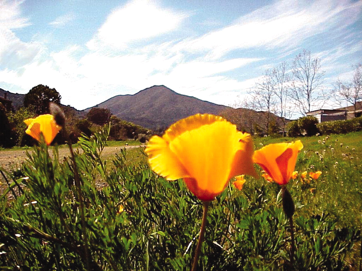
At Mount Tamalpais State Park, lovers of the great outdoors can saunter through redwood groves to open hillsides sprinkled with wildflowers and end up in command of a view from which very little is hidden.
Standing on the 2,571-foot peak, known as “Mount Tam” among locals, visitors are also treated to the ultimate perspective: the Farallon Islands 25 miles out to sea, the rolling brown hills of Marin County, San Francisco Bay, Angel Island, the Tiburon peninsula, the hills and cities of the East Bay, and even further east, Mount Diablo.
On an exceptionally clear day, some can even see the snow-covered peaks of the Sierra Nevada Mountains 150 miles away.
The park surrounds Muir Woods National Monument (see
facing page).
The park’s name, Tamalpais, is derived from the language spoken by Miwok Indians, who inhabited the area thousands of years ago. Tamalpais, when translated, means “coastal mountain.”
Panoramic Highway and Ridgecrest Road, steep and winding roads that take visitors to the top of Mount Tam, also offer spectacular views: caverns, cliffs, and hay-colored fields rolling toward the Pacific Ocean. Perhaps not surprisingly, these very roads are a mecca for photographers shooting car advertisements.
According to the California Film Commission, more than 60 ads have been shot on the roads leading to Mount Tam.
Exercising in the Great Outdoors
Mount Tam is one of the Bay Area’s most popular places for hiking. An extensive network of trails covers the mountain, offering a variety of routes from the lowland valleys and surrounding areas up onto the summit ridge.
There are 50 miles of trails within the park that connect to a 200-mile trail system on adjacent public land.
Hiking on Mount Tam is perhaps the best way to appreciate the park’s natural beauty. A variety of trees and plants thrives in the park, among them, California laurel, Douglas fir, and wildflowers. Hikers can stride through redwood canyons and over ridges covered with chaparral, a dense shrub that thrives in arid conditions.
Wildlife Abounds
In addition, hikers may see gray foxes, bobcats, coyotes, black-tailed deer, turkey vultures, and red-tailed hawks scrambling around (or flying over) the 6,300 acre park.
The following are some of the popular hiking trails on Mount Tam, beginning with the shortest hikes:
• Pantoll Easy Grade Trail/Mountain Theater/Old Mine Trail/Pantoll: This two-mile hike follows a moderate grade up through a mixed evergreen forest to the Mountain Theater, a stone amphitheater constructed by the Civilian Conservation Corps in the 1930s. The theater is home to the Mountain Play, which is staged on Sundays throughout the summer. The return trip to the Pantoll trail via the Old Mine Trail offers spectacular views.
• Pantoll/Old Mine Trail/Dipsea Trail/Steep Ravine Trail/Pantoll: This 3.5-mile loop takes hikers through an evergreen forest and over rolling hilltops with views of the bay and ocean. Dropping down into a redwood canyon, Steep Ravine Trail follows Webb Creek back up to Pantoll.
• Pantoll/Matt Davis Trail/Coastal Trail/Willow Camp Fire Road/Laurel Dell Fire Road/Cataract Trail/Old Mine Trail/Pantoll: A six-mile loop brings hikers through patches of forest into open grassy areas blooming with wildflowers in the spring. Hikers who wish to stop and eat lunch can do so at Laurel Dell Picnic Area at the hike’s midpoint.
• Pantoll/Easy Grade Trail/Mountain Theater/Rock Springs Trail/WestpointInn/Old Railroad Grade Fire Road/East Peak/Old Railroad Grade Fire Road/West Point Inn/Old Stage Coach Road/Pantoll: This is perhaps the most popular hike to the summit of Mount Tam. The trail starts in an evergreen forest and winds past the Mountain Theater and the West Point Inn, where several rustic cabins are available for lodging. It also follows the route of an old railroad as it leads hikers up to the 2,571-foot peak.
Mount Tamalpais State Park is located just north of San Francisco in Marin County at 801 Panoramic Highway in Mill Valley. More information about Mount Tamalpais is available on the Web at www.parks.ca.gov or by phone at (415) 388-2070. ▪

