About 6 million years ago, volcanic eruptions gave rise to the oldest and arguably the most naturally beautiful of the Hawaiian Islands, Kauai, which is also known as the Garden Isle because of its abundance of tropical flowers.
The island may seem familiar to many who have never even landed on its shores; with breathtaking views and lush foliage, it is no wonder that more than 70 films and television shows have been filmed on the island, including parts of the films "Jurassic Park," "Pirates of the Caribbean," "Raiders of the Lost Ark," and the opening scene of the long-running TV series "Fantasy Island."
The diversity in terrain and weather is another feature that makes Kauai unique—the wettest spot on earth is here: with an average of more than 472 inches, or 39 feet, of rainfall each year, Mt. Waialeale on the island's west side rises 5,148 feet above sea level and acts as a funnel for moisture (see
Multiple Options for Exploring Kauai).
Moisture Creates Dramatic Canyon
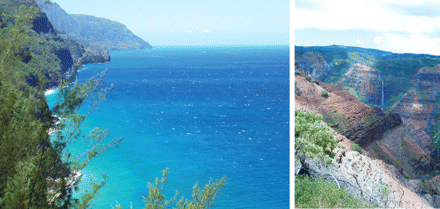
Over millions of years, rain from Mt. Waialeale has eroded the island to etch deep valleys into the landscape, forming Waimea Canyon. Almost as low as Mt. Waialeale is high, the floor of the canyon is more than 3,000 feet deep in some places. The canyon is 10 miles long and is at the center of Waimea Canyon State Park, which encompasses nearly 3,000 acres and features walking trails, wooded areas, and scenic lookouts. The Waimea River, which helped to form the canyon eons ago, still flows through the gorge.
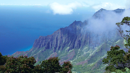
Heading north from the canyon, visitors will find Kokee State Park, home to 45 miles of hiking trails and easily the most gorgeous lookout on the island that's accessible by foot—the Kalalau lookout, which affords unfettered views of the Kalalau valley and its miles of luxuriously green-carpeted spires leading down to the ocean. On the west side of the island are the small towns of Waimea and Hanapepe, the latter featuring a number of art galleries, eateries, and shops.
Southern Shore Features Beaches, Restaurants
The southern shore of Kauai is home to historic Old Koloa Town, once at the heart of nearby sugar plantations, and the resort area of Poipu. Welcoming visitors to Koloa and Poipu is a canopy of towering eucalyptus trees planted more than a century ago along Maluhia Road.
Poipu Beach Park has been named one of America's best beaches, and nearby is the Poipu Shopping Village, with a number of restaurants and boutiques. Also on the south shore are two national botanical gardens: McBryde Garden, featuring 259 acres of native and rare plants, and Allerton Garden, an 80-acre garden known for its giant Moreton fig trees.
Another gem of the southern shore is the Spouting Horn Blowhole, near Poipu beach. Here, the Poipu surf is channeled into a naturally formed lava formation, which releases a giant spout of water during large swells. The landmark is tied to a colorful myth perpetuated by generations of native Hawaiians—legend has it that the area was once protected by a giant lizard named Kaikapu, who, when chasing a young boy, was caught in the tube of lava. The resulting hiss and roar of the spouting water is said to belong to the lizard.
Eastern Shore Beaches Especially Popular
Kauai's east coast is sometimes known as the Coconut Coast for the groves of coconut palms that thrive there. This is where the majority of Kauai's 60,000-some residents live, specifically in the towns of Wailua and Kapaa. Wailua affords opportunities to explore Wailua River State Park and kayak the Wailua River or to hike into the Nounou Mountains to the summit of the Sleeping Giant, a mountain that looks like a reclining person.
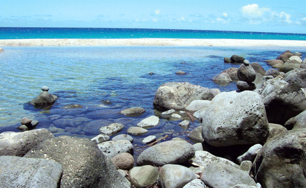
The golden beaches of the Coconut Coast may be the area's biggest attraction, however, with scores of snorkelers, sun worshippers, and surfers heading to Anahola Beach Park, Lydgate Beach Park, and Donkey Beach, which, despite its name, is a prime spot to whale watch.
Breathtaking Views Dot North Shore
Kauai's north shore sets the scene for spectacular and dramatic views of pristine white beaches, emerald green mountains, and cliffs dropping into the Pacific. At the northernmost point, Kilauea Lighthouse affords great views of humpback whales, which can be viewed through the binoculars on a nearby platform. The area also is a wildlife refuge and home to a variety of birds, including frigates, shearwaters, boobies, and Laysan albatrosses.
Nearby Hanalei offers tourists unique eateries and boutiques, and in Princeville are world-class golf courses, historic bed and breakfasts, and the very upscale St. Regis Princeville Resort—a must-see even for those not staying overnight.
One of the most beautiful hikes on the island—and perhaps on Earth—starts at the North Shore's Ke'e Beach. The Kalalau Trail stretches along 11 miles of sometimes rocky terrain to Kalalau Beach and, along the switchbacks, offers stunning views of the ocean and the Na Pali coastline.
The Na Pali coastline is the jewel in the island's crown. The 17-mile stretch has sweeping green valleys leading up to chalk-white cliffs standing 3,000 feet above the Pacific. While the area is inaccessible by car, it can be experienced on foot or by air or sea.


